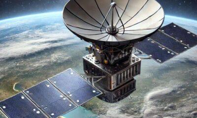
Geospatial
The Impact of the Russia-Ukraine War on Geospatial Intelligence

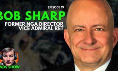
GEOINT (geospatial intelligence) has changed a lot since it became an official discipline in the 90s. That has never been so obvious as in the Russia-Ukraine War. For the first time, the military has sourced intelligence from social media and shared the intelligence they have gathered with the American public. Dr Robert Clark has been in the geospatial intelligence field since its inception and shared his interesting insights on the evolution of the military’s use of geospatial intelligence.
The Origins of Geospatial Intelligence
One of Dr Robert Clark’s first jobs in the geospatial intelligence field was as a new analyst with the CIA in the mid-80s. The Soviets began building two large transmitting antennae that were taller than the Washington Monument, and the length of the antenna were almost as long as the National Mall. Dr Clark and his colleagues were tasked with finding out what the antennae do.
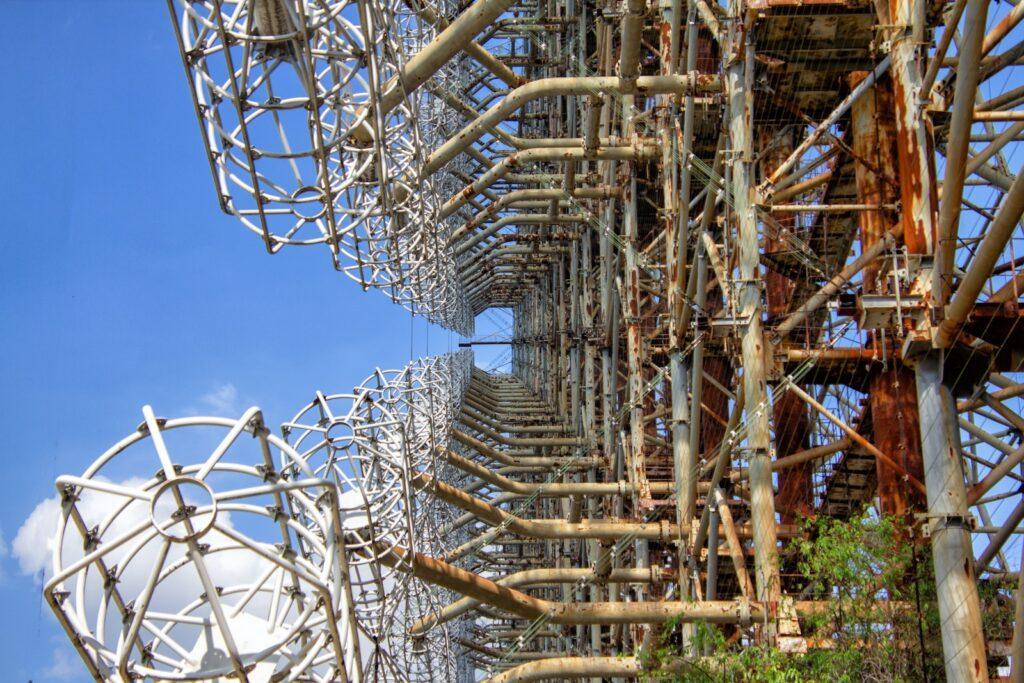
The process involved making observations about the functionality of the antennae based on the data and piecing things together. For example, they looked at where the antennae pointed and the beacon, which led to the realization that it was not a line of sight radar; instead, it reflects off the ionosphere and back to earth to provide a longer range. Based on the fact that the antennae was pointed at the US missile fields, it was concluded that it must be an Early Warning System for ballistic missiles.
Dr. Clark was a little uncertain about that conclusion as the US missile fields were located 5,000 miles away from the antennae, meaning the radar would have to bounce twice or three times off the ionosphere and travel through the auroral zone. His background in geospatial intelligence helped inform him that it was unlikely that the antennae would be able to detect a missile launch outside of a two-hour window.
Years later, they found out that both conclusions were true. Russian leaders were so desperate for a ballistic early warning system that scientists sold the Soviet Government on the idea so they could build the system they were looking for. Dr Robert Clark likes to say that his introduction to analysis taught him a basic lesson:
“The other guy isn’t always going to make logical or even reasonable decisions. If you’re in intelligence, you have to accept the possibility that the other leaders are going to make bad decisions.”
Dr. Robert Clark
Geospatial Intelligence in the Russia-Ukraine War

The United States’ approach to the Russia-Ukraine War provides the perfect contrast for the evolution of geospatial intelligence. Intelligence collection for the Russia-Ukraine War has utilized open source intelligence (OSINT), in particular social media data. Check out this awesome interactive map of the Russia-Ukraine War for latest updates on the conflict.
Videos filmed by people on the ground and posted to social media have helped significantly in intelligence gathering. Anyone can go on social media or YouTube and see ground level videos documenting what is going on in the war. These are filmed by people living in the area or even soldiers. This has informed not only civilians watching from around the world but military intelligence. A perfect example of this is the Russian troops who were killed recently because they posted on social media and tagged their location! The number rule of war, don’t post your location on social media or you’re likely to get an unwelcomed introduction to kinetic energy.
On the one hand, this has been incredibly useful, but on the other hand, it was unexpected and created a situation where geospatial intelligence experts almost have more data than they know what to do with. It can be easy to become overwhelmed dealing with crises that are popping up rather than planning for the medium or long term.
Another interesting thing that has happened during the Russia-Ukraine War is that the military has shared intelligence with the general public. When intelligence indicated that Russia was planning a disinformation campaign, the government decided to release that intelligence via social media and press releases to disrupt their plans. The intelligence was, of course, sanitized first, but this is one of the first times that has happened, and the tactic must be frustrating for the Russian military.
Dr. Robert Clark says that the intelligence cycle has changed significantly behind the scenes too. In the past, the intelligence cycle was broken into very distinct stages:
- The collectors would receive information about what data needs to be collected, and they would collect that data.
- The processors would process the data via translation, decryption, or annotations.
- The analysts would analyze the data to give it context and note the key takeaways for the decision-makers.
- The decision-makers would look at the analysis and ask questions, causing the process to start all over again.
Now, object-orientated models are used for a more collaborative process. All of the parties above are included in the entire process, including the decision-makers. For the intelligence experts, it makes knowledge sharing more efficient. For the decision-makers, it allows them to better trust the intelligence they receive because they were involved in the process and can see how the conclusions were reached. Now its more like building a sandcastle together versus an assembly line.
The Three Types of Intelligence: Descriptive, Predictive, and Prescriptive
The first is descriptive intelligence, where the goal is to just collect data on what is going on so that the end-user has a full description. The second is predictive intelligence, where the analysts take descriptive intelligence and look for patterns so they can predict events based on trends. The third is prescriptive intelligence, where the analysts make recommendations based on their predictions.
Usually, geospatial intelligence (GEOINT) professionals prefer to stick to the first two types of intelligence because they are only handling the geospatial data and, therefore, may not have the full picture. There may be other data that is being analyzed by other analysts. GIS analysts may be reluctant to take partial responsibility for what happens based on their recommendations.
This article was taken from a conversation on the NDS Show Podcast with Dr Robert Clark, who has literally written the book on geospatial intelligence collection! Watch the full episode on YouTube to learn about the origins of GEOINT and how technology and modern conflicts have shaped modern intelligence collection techniques. Subscribe to The NDS Show on YouTube to stay up to date with the latest in the geospatial intelligence field.