Geospatial
How Geographic Information Systems (GIS) Support Everyday Efficiencies
Geographic information systems (GIS) affect multiple aspects of our life, whether we are aware of the impact of GIS or not. An obvious application of GIS is the GPS tools we use for navigation, but did you know that geospatial intelligence is behind your online shopping, sporting events, and even your education? Recently, Steven Stout from Geo Owl shared the surprising ways in which GIS has made our everyday lives more convenient.
What Is GIS?
Geographic information systems (GIS) are built to house data with a spatial component that you can overlay to extract meaning, relationships, trends, and patterns from. The geographic component allows patterns to emerge that may not otherwise be evident.
The best example of this is one of the earliest uses of GIS. In the mid-1800s, Dr. John Snow found the source of the cholera outbreak by mapping the locations. The map showed that the cholera outbreak was clustered around the water lines. Thus, he discovered that the cholera outbreak was caused by contaminated water.
This is Dr. John Snow’s Map of the Area around Golden Square during Cholera Epidemic.
Many consider this to be the founding of GIS. On a basic level, GIS is just overlaying data on a map to see how the data points are spatially related. Everything that’s happening has some sort of geographic component to it. When GIS is properly harnessed, it can be used to find efficiencies that have enabled many of the conveniences we enjoy today.
How GIS Improves Our Everyday Lives
GIS is working behind the scenes in almost every aspect of our lives. Most people probably wouldn’t notice the presence of geospatial intelligence, but the absence of GIS would be noticeable.
Jack Dangermond, the Founder of ESRI – the world’s leading provider of GIS technology, once said, “The application of GIS is limited only by the imagination of those who use it.” Here are some of the ways that GIS optimizes your daily life.
“The application of GIS is limited only by the imagination of those who use it.”
GIS in Urban Planning
Our cities are planned using GIS to ensure that resources are allocated where they are needed. For example, local governments use geospatial intelligence to analyze when an area needs additional schools or teachers. GIS analysts also help cities plan transportation routes and even things like the placement of grocery stores. The absence of GIS in urban planning can result in issues like food deserts because certain parts of cities do not have easily accessible grocery stores.
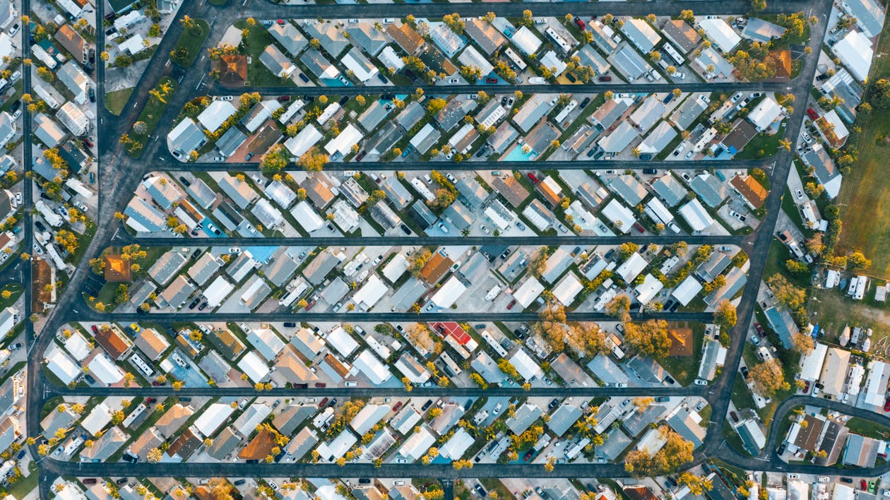
Urban planners use tools like ArcGIS and QGIS to analyze development data and inform their land zoning. These GIS technologies help local governments decide on how to best allocate resources and use the land so that residents thrive. For example, before approving housing developments in an area, GIS analysts will look at a number of factors to consider if the land is optimal for residential use. They will consider if the area is prone to flooding if there are sufficient resources around to support additional residents, etc. If they are approving additional green spaces, the city will use GIS to analyze the total area to determine the amount of space suitable for recreational use versus the amount of space needed for tax revenue generation.
GIS for Deliveries
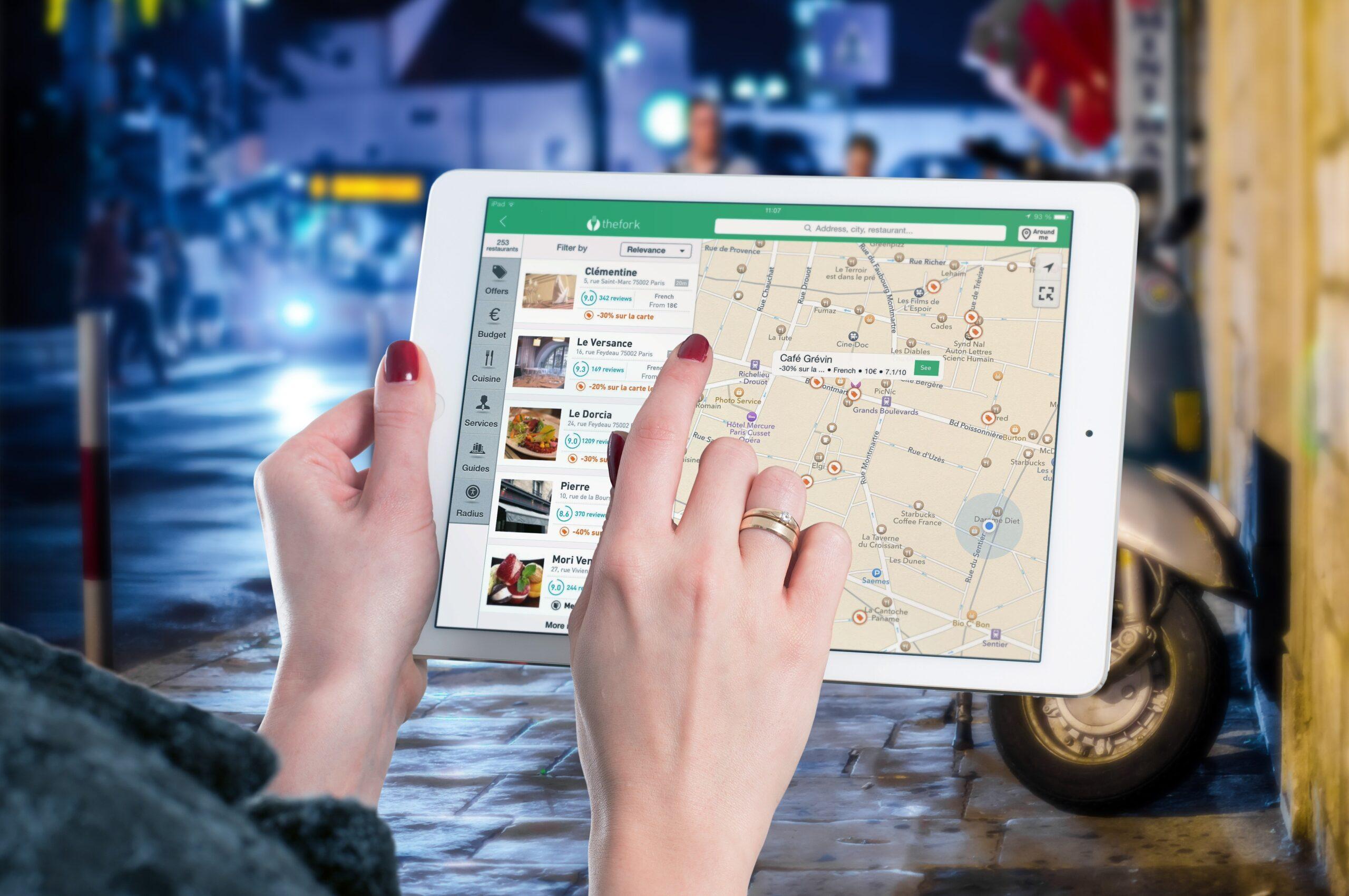
All deliveries we receive use GIS to optimize the delivery process. This includes mail, grocery deliveries, and Amazon parcels. GIS allows delivery companies to sort deliveries and pack delivery vans based on delivery location. Without GIS, parcels may be sorted on a first-in, first-out basis or by something arbitrary like product type. This will result in an inefficient delivery schedule where trucks are driving all over town rather than delivering by area. GIS is what empowers same-day or next-day deliveries.
GIS in Events
When your allocated parking is on the other side of the stadium from your seats, or you are told to enter the stadium using an entrance nowhere near your allocated seats, this shows an absence of geospatial planning. Whether you’re attending sporting events or concerts, GIS adds efficiency to large events. It helps event spaces place parking where it is needed most and allocate seats, entrances, and parking to achieve efficient crowd control.
GPS Tools
We all use GIS every single day when we use mapping tools like Google Maps, Waze, and Apple Maps. GIS powers our phone location services, GPS tools, and even our transport route planning apps. Tools like Waze, for example, crowdsource data to provide up-to-date information about traffic and obstacles. As users input information about their route, Waze links that with their location to display notifications along your route.
GPS tools (and the GIS behind them) have also brought about technology that we use every single day. They make expedited delivery services possible, as discussed above, and they are a necessary part of rideshare technology and public transport. GPS tools also allow 911 operators to see your location and dispatch emergency services when you need them.
Cloud-Based GIS
Recently I spoke to Steven Stout, Director of Geospatial Solutions at Geo Owl, who wanted to see GIS moved to the cloud to allow geospatial intelligence to be shared more easily. This will allow the geospatial data to be handled by the people who are collecting and using that data on a regular basis but accessed by anyone who needs it.
Moving GIS to the cloud will allow the state government to access data from all of the counties in their state at once rather than having to contact each county and ask them to send the data they need. This will make analysis and planning more efficient and will hopefully lead to faster identification and resolution of issues. The current model makes it easy for issues to go unnoticed because there is no central database.
Learn more about the future of GIS and the challenges the geospatial intelligence field faces over on the NDS Show Podcast. Watch my conversation with Steven Stout about GIS and what to expect to see in the future.