Geospatial
The Technological Advancements at the Frontline of the Climate Change Fight

A decade ago, it seemed like all we talked about was climate change. In the last few years, there has understandably been more on our collective minds, but have any of the technological advancements we’ve seen in the previous few years are helping in the fight against climate change? As a professor of Geography and Geospatial Science, in the Earth and Ocean Sciences Department at the University of North Carolina Wilmington and a Science Policy Advisor to the United Nations Convention to Combat Desertification (UNCCD), Dr. Narcisa Pricope, PHD is a great source of information about the latest technological advancements in her field and how they are supporting her work.
What Is Geospatial Science?
Geospatial science is a field which examines data collected on GIS (Geographic Information Systems) to look for patterns that help them to understand environmental phenomena and predict trends. As a discipline, geospatial science is both visual and data-driven. Geospatial Scientists collect data from the physical location by mapping it using various types of imaging and sensors. Then, they analyze the data to identify patterns or relationships.
There are many different applications of geospatial science. It can be used to:
- Predict flooding risk in populated areas
- Map seafloor topography to find vehicles which have sunk to the bottom of riverbeds or oceans
- Integrate the physical world into gameplay like with Pokémon Go
- Identify the probable location of mineral deposits
- Tracking the rate that the icecaps are melting
- Analyzing topography and tectonic activity
Dr. Narcisa Pricope’s primary focus is the way that humans are impacting their environment and how the changing environment, in turn, impacts human responses. She is currently working on the SDI (Sustainable Development Initiative) with 14 other scientists to track land degradation for the UNCCD. Policymakers across the world look to the findings of their research to create plans to achieve their 2030 Agenda on Sustainable Development goals.
The Climate Change Applications of GIS
While the SDI is focused on desertification, they collect data about a wide range of environmental phenomena. The environment is made up of tightly interconnected components that create one big global ecosystem. That means that seemingly unrelated factors can impact land degradation. It also means that even though land degradation impacts some areas of the world more than others, it is a global mechanism.
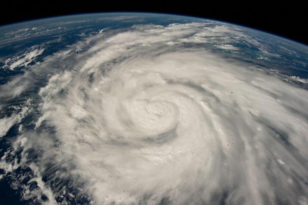
Dr. Pricope gave the example that land degradation in Africa can increase the occurrence of hurricanes on our East Coast. The desertification in North Africa leads to more wind and dust storms. Those dust storms fill the atmosphere with dust globally, which creates nuclei for condensation. This, in turn, causes more cloud formations that instigate these low-pressure systems that spin out of control and become hurricanes on the US Atlantic coast.
The data that Dr. Pricope and her colleagues collect help them to better understand how everything is connected and the impact that certain factors have on climate change. The SDI release their findings in a report that informs policy decisions for the member countries of the UNCCD. While the SDI doesn’t have the power to make recommendations to member countries, it can keep policymakers up to date on the latest scientific knowledge regarding desertification, aridity, and land degradation.
The Technology Monitoring Climate Change
Technology supports the data collection of Geospatial Scientists like Dr. Pricope. As technology advances, scientists are able to collect and analyze more data at a faster rate. This allows them to see patterns and relationships that they were previously unaware of, which, in turn, leads to new discoveries about the causes of land degradation and other types of climate change.
3 most commonly used geospatial technologies that climate scientists like Dr. Pricope use are Landsat satellites, LiDAR, and AI technology.
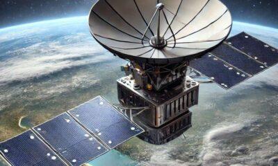
NASA Landsat Satellite Constellation
Landsat satellites are valuable resources for tracking how areas have changed over a period of time. That is why NASA’s next-gen satellites are a good investment. In addition to being another satellite collecting data, NASA’s new satellite has 26 spectral bands, compared to Landsat 8’s 11 spectral bands. This will give scientists the ability to take images of things that they did not previously have the capacity to take images of.
Dr Pricope predicts that this will provide them with data on how different areas and land coverings are responding to incoming electromagnetic radiation. The additional spectral bands should allow Geospatial Scientists to study these responses on a species or mineral level. In particular, NASA’s Landsat Next will fill in a lot of blanks around the shortwave infrared spectrum and other parts of the spectrum that are currently blocked by atmospheric windows of transmission.
Lidar (Topographic and Bathymetric)
Scientists use LiDAR to map out the 3-dimensional topography of specific areas. LiDAR uses lasers, scanners, and GPS receivers to collect data. There are many different types of LiDAR, for example, your iPhone has LiDAR to help your phone’s camera to focus better. Climate scientists’ data collection is supported by the two following types of LiDAR:
- Topographic LiDAR – uses near-infrared lasers to create 3D point clouds and map land.
- Bathymetric LiDAR – uses green light lasers to penetrate water to map riverbeds and the sea floor.
The SDI uses drones with LiDAR to produce 3D topography of large areas more quickly. Multiple drones will work together to image various aspects of the area. Dr. Pricope recently earned and was awarded a grant that allows UNCW to equip the first coastal UAS (unmanned aerial systems) observatory and they are equipping their drones with topographic LiDar, bathymetric LiDAR, hyperspectral sensors, multi-spectral cameras. This in conjunction with in-situ instrumentation will help them ask and answer questions about how the coast is changing.
AI Technology
Dr. Pricope believes that AI technology is a huge help to the geospatial intelligence field because it will make the work more efficient. Geospatial experts are handling large amounts of data, so they use AI technology often in their field to create code to help scientists to deal with that volume of data. As the tools that they use send them more data, like NASA’s new Landsat will, they need to be able to process and analyze the additional data to reveal useful information.
AI tools like ChaptGPT will automate a lot of the brainstorming, research, and task organization that Geospatial Scientists do. Dr. Pricope predicts that AI technology that leverages language models will be useful in writing the first draft of code that Geospatial Scientists can then modify for their needs. It may even help with troubleshooting errors in code if needed. Interested in learning about GIS and the geospatial intelligence field? This article comes from a fascinating conversation I had with Dr. Narcisa Pricope on the NDS Show Podcast. She spoke at length about her work, the technology she uses, and the future of the field. Subscribe to The NDS Show on YouTube to stay up to date with the latest!